Get ready for the trip of a lifetime on the Cradle Mountain Signature Walk (formerly known as Cradle Mountain Huts Walk) – a seven-day, six-night all inclusive adventure on the renowned Overland Track in Tasmania’s UNESCO World Heritage Wilderness area.
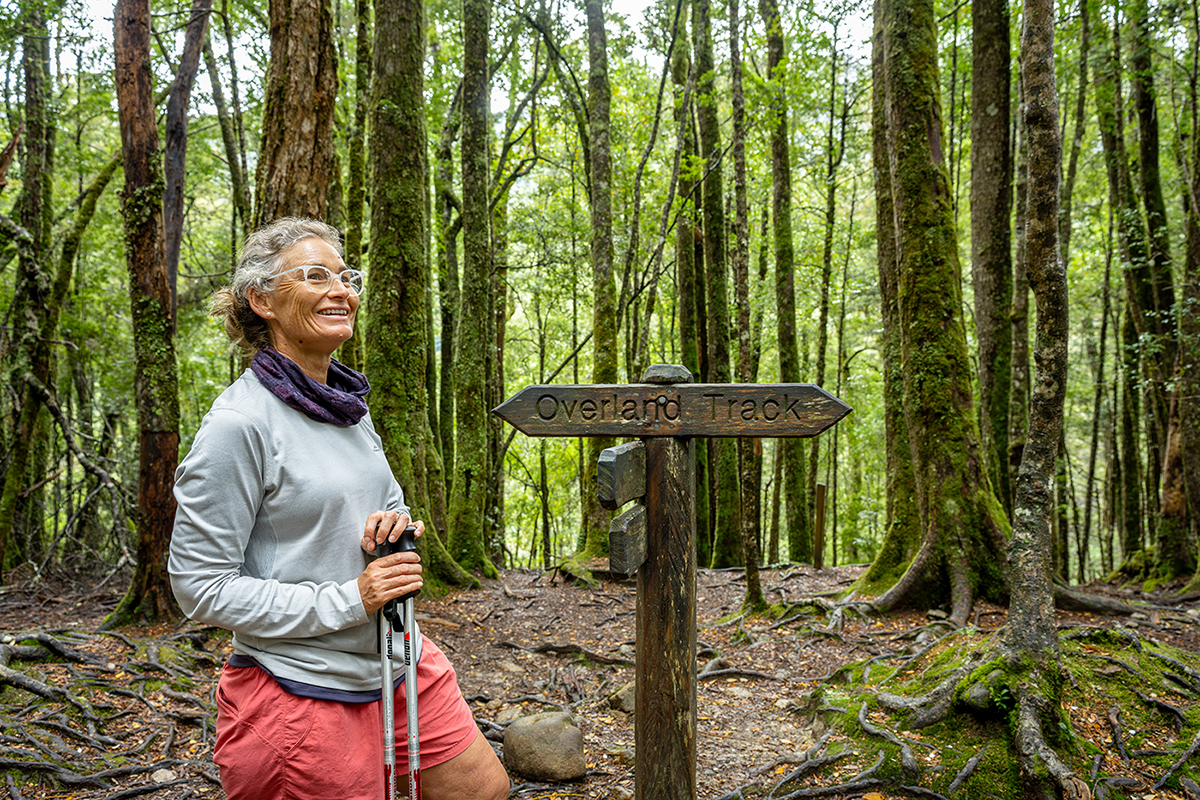
Australia’s premier multi-day alpine walk, the Overland track is on the bucket list of many hikers and this is the ultimate way to experience it. Levels of wonder and awe is high as you walk through this majestic and pristine national park, experience its extraordinary nature and the peacefulness of its remote wilderness.
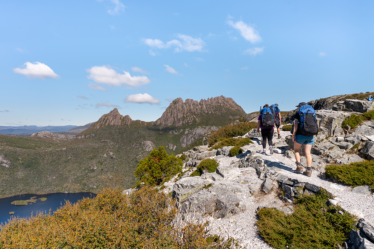
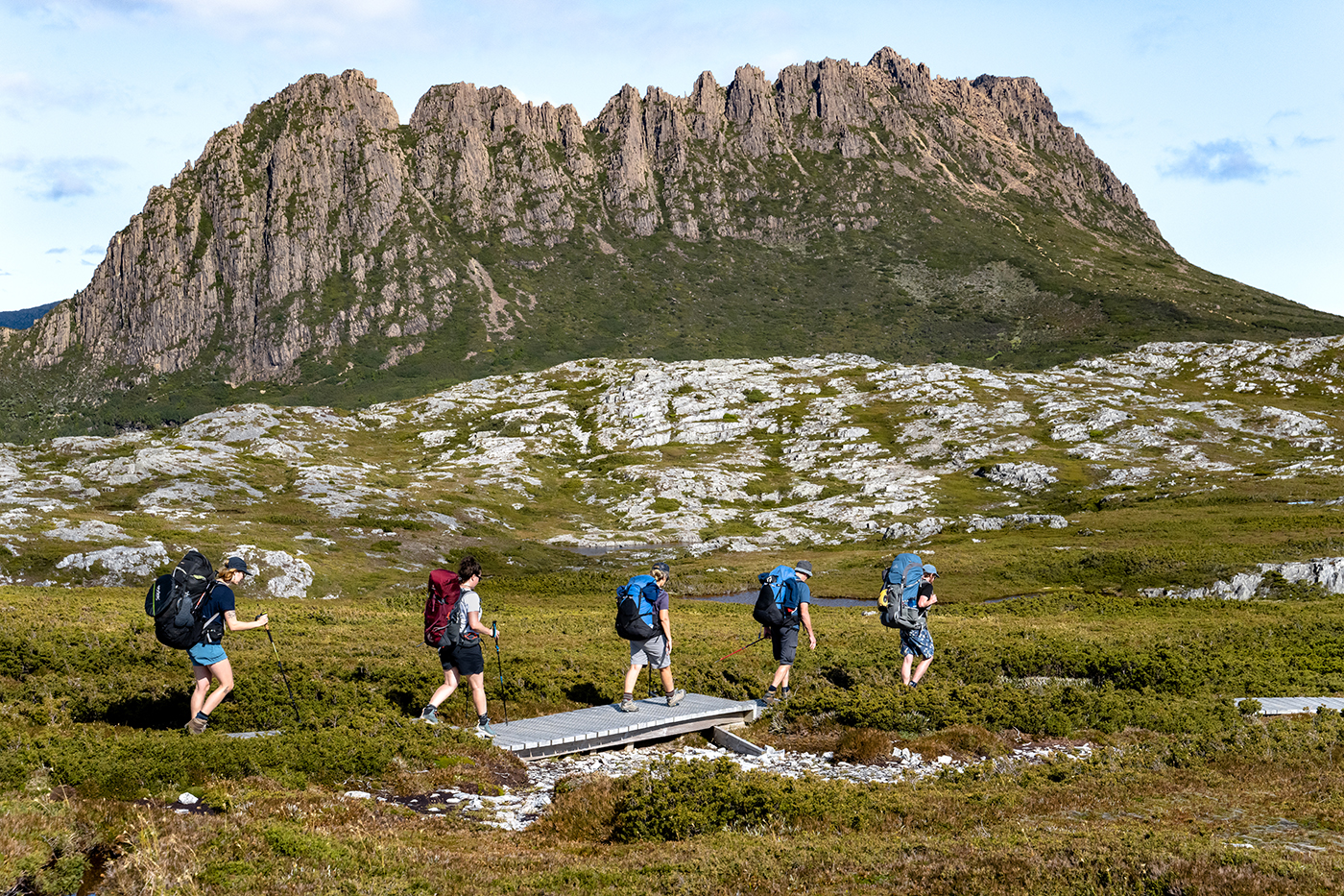
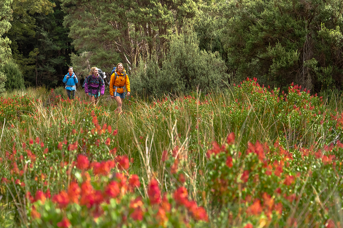
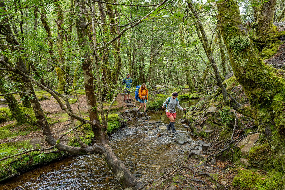
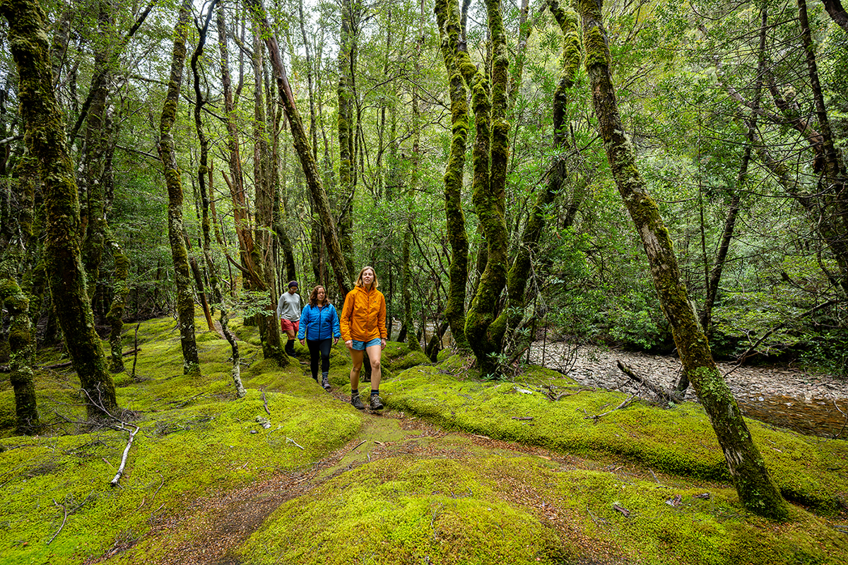
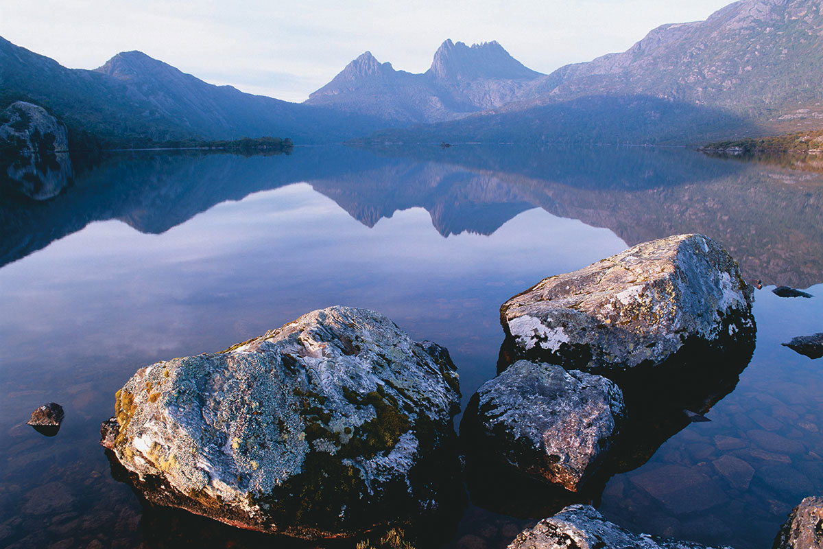
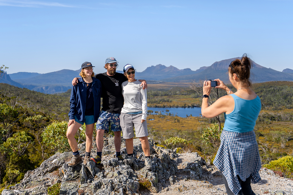
Over 65km, hikers explore Cradle Mountain-Lake St Clair national park’s spectacular and diverse terrain, including mountain climbs, button grass plains, temperate rainforests, alpine meadows and open moorlands, and wander past lakes, rivers, tarns and beautiful waterfalls.
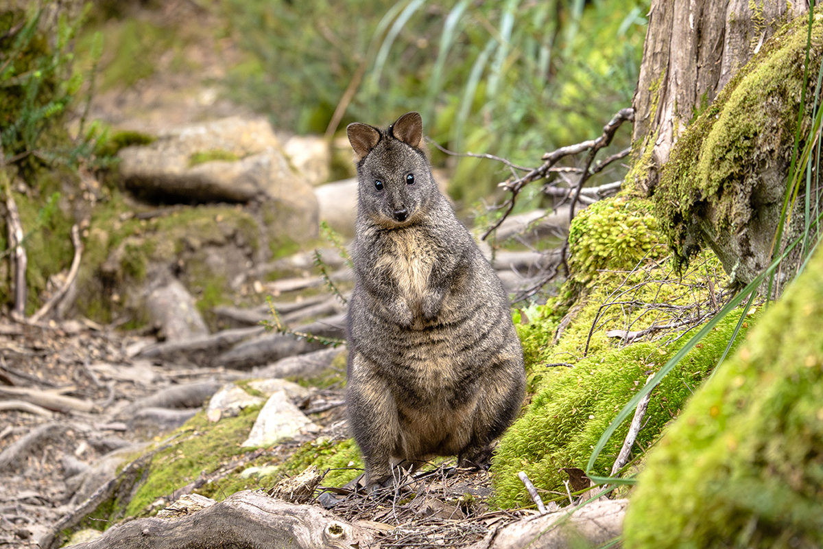
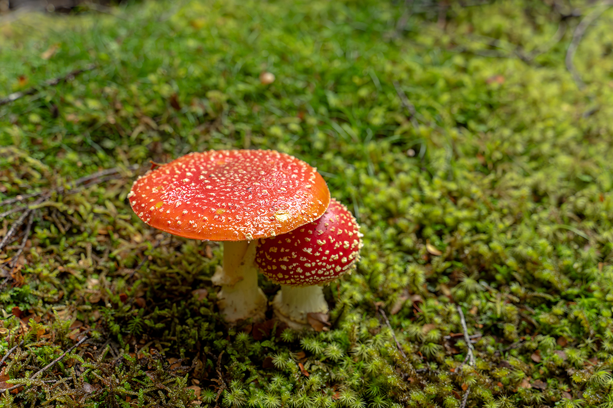
Wildlife encountered along the way may include wombats, paddymelons, echidnas and an array of birdlife. The area is also home to the Tasmanian Devil.
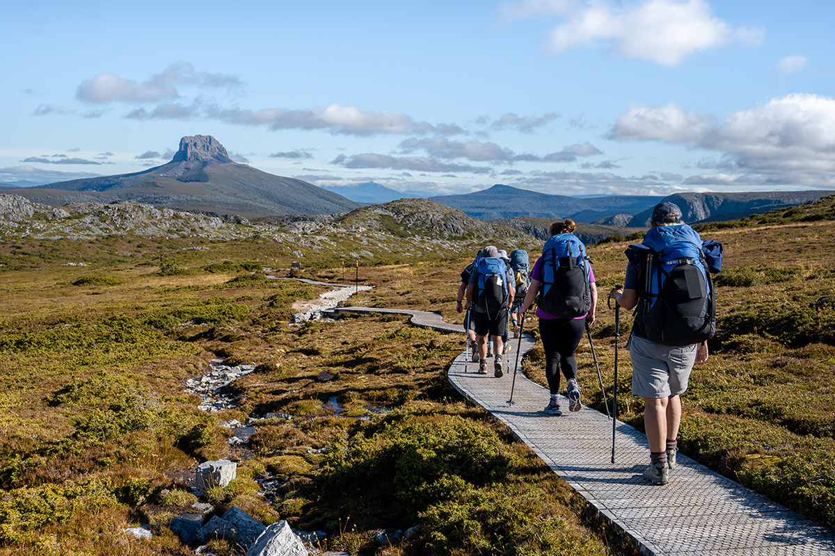
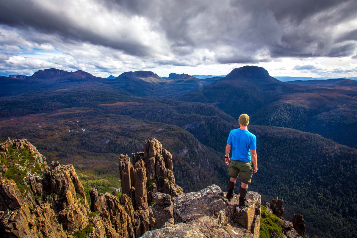
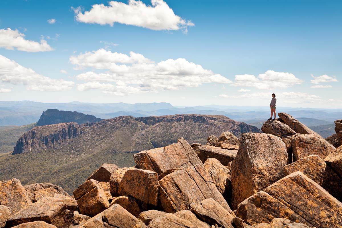
A side trip to Mt Ossa – the highest peak in Tasmania – is a highlight of the track and a real achievement for many walkers.
Ending your trip with a beautiful 17km boat trip across Lake St Clair is the perfect way to celebrate the end of the journey before returning to Launceston.
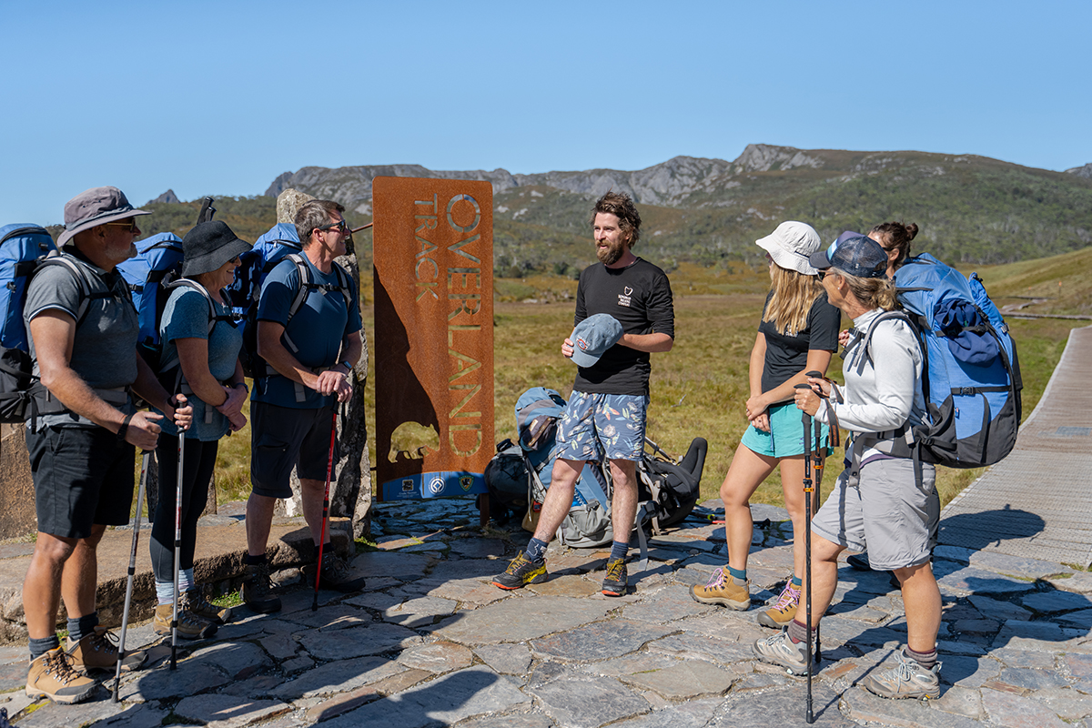
Enjoy walking in a small group, with a maximum group size of 12, being led by friendly, highly experienced guides, who will share their expert knowledge and insights about this rugged wilderness paradise along the way.
Exclusive Accommodation
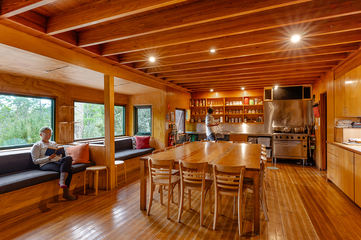
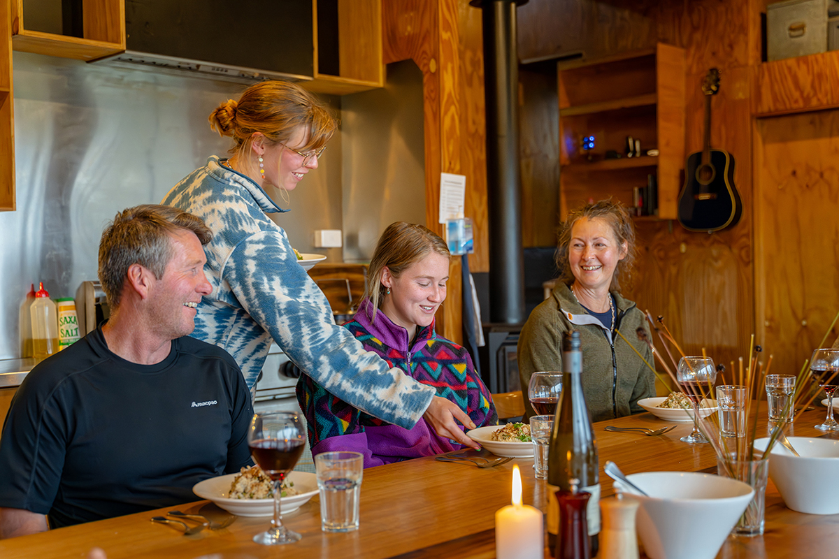
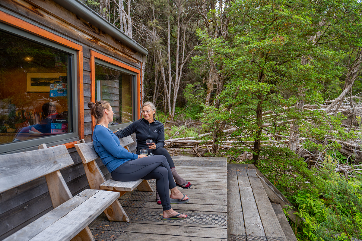
At the end of each day, you’ll wind down in the warmth and comfort of the only private accommodation on the Overland Track. These eco-lodges are discreetly located off the main trail, are exclusive to our guests, and offer hot showers (the only showers anywhere on the track), a drying room and twin-share accommodation.
Your guides will prepare an inspired three-course dinner each night while you sit back and relax with a glass of Tasmanian wine in front of the fireplace, unwinding from a big day with your fellow hikers in cosy comfort.
Walking in the seasons
This walk officially operates seasonally from October to early May each year. The weather conditions around Cradle Mountain are prone to change at any time and are part of the adventure of doing the Overland track. Sun, rain, wind and snow can and likely will be encountered at any time of year.
In the winter months, Tasmanian Walking Company also offers a select number of winter departures.
Equipment
Guests carry light packs with their clothes/belongings for the duration of this walk. A pack and rain jacket will be provided for you. A full packing list will also be provided to ensure your pack is as lightweight as possible.
Snowshoes and/or crampons are also provided if conditions require.
Walking poles are available for hire.
Committed to the Environment
Each hut on the track is operated under stringent environmental regulation and is designed with sustainable architecture to maximise ventilation, passive energy and other efficiencies.
The remote location of the huts demands that they are autonomous in terms of servicing. Rainwater is channeled off the roof into tanks and self-composting, and water-free batching toilets and phosphorous-free soaps are used. All waste water is separated through grease traps and sand filters and the residue is physically removed from site regularly, along with any other rubbish generated. Gas and solar are the only sources of power used for lighting, heating and cooking.
The provisioning of these huts is a unique procedure, once again due to their remote location. Twice each season, supplies of food, wine and gas cylinders are flown in by helicopter over a two-day period, while all garbage and waste matter is flown out. Nothing is left within the National Park.
Walk Overview
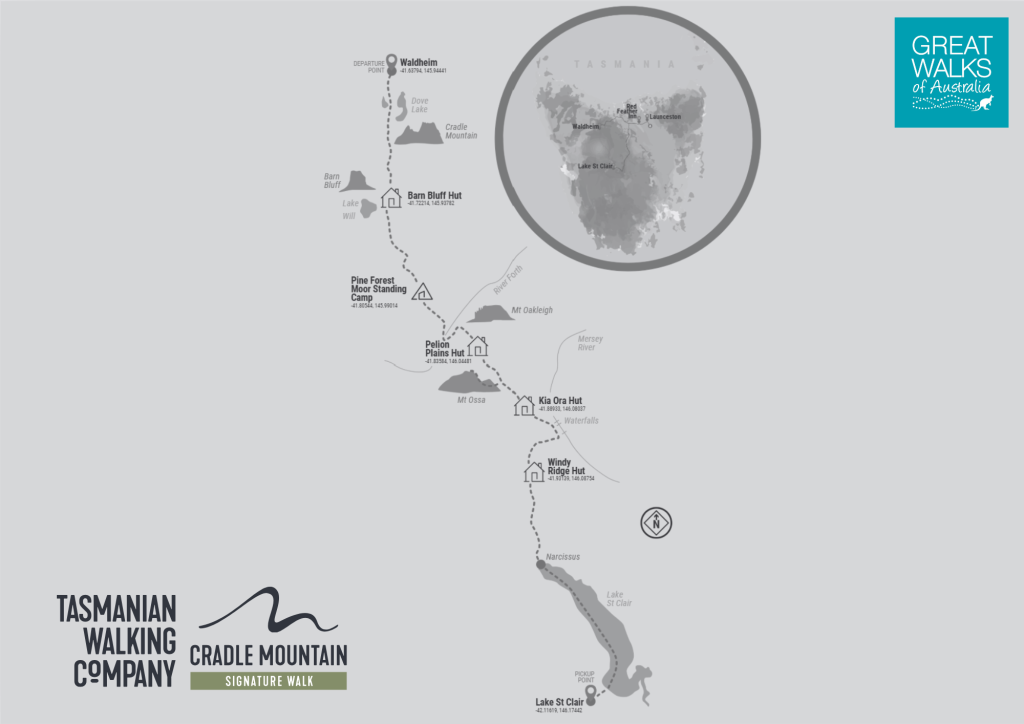
- Accessed via Launceston, TAS
- Duration: 7 days / 6 nights
- Distance: 65km
- Grade: Moderate to Hard
- Walk operates: October – May
- Bush trails, boardwalks, rocky areas, mountains + forests
- Group size: Max 12
- Rates: From AUD $4,495 per person twin share


Reviews

"Bliss... If you want to experience the Overland Track and feel like a rock star then get on the Cradle Mountain Huts train. Light packs, great accommodation, fantastic food, Professional with a capital P guides, and a wilderness like none before. Easily one of the top 10 walks on the planet!"
John, Sunshine Coast – Trip Advisor
Elevation Graph
This graph loosely depicts the gradient of the track, providing you with some basic understanding of how challenging the walk will be. The graphs are useful in helping you decide which walk suits you best. Whatever your ability or fitness, there’s sure to be a walk that suits you in the Great Walks of Australia collection.
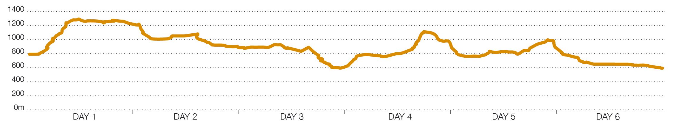
* Elevations are indicative only and are not to scale. Walkers should contact individual walk companies to better understand the terrain and difficulty of each walk.
-
Walk Itinerary
- Day One Briefing and welcome dinner Preparing for a big walk is crucial, that is why we start our Cradle Mountain Signature Walk the night before at our walker base at the historic and quaint Red Feather Inn. Here you will meet your guides as they take you through what to expect from the next six days and conduct a gear check. After our short briefing, the night of celebration begins... your Overland Track adventure is finally here! Get to know your fellow walkers over a dinner of local fare, cooked for you by the in-house chef and paired with local wines. The rooms at Red Feather Inn are designed for your comfort, giving you the perfect excuse to head off to bed early and get a restful night's sleep before your early start the next day.
- Day Two Waldheim to Barn Bluff Hut. 12 km, 7 hours walking. We set off on the track, venturing through ancient temperate rainforest, passing the dramatic glacially-carved Crater Lake. We climb the steepest section of the whole Overland Track today and pause for a hearty lunch. Reaching Marion’s Lookout (1,250m) after negotiating steps leading through steeper sections, offers a satisfying reward. Providing weather conditions allow, we enjoy staggering views of Cradle Mountain and Dove Lake. We continue around the base of Cradle Mountain along the edge of a spectacular glacial cirque before dropping into Waterfall Valley. Our private hut awaits, beneath towering Barn Bluff, having completed the steepest part of your journey (excluding side trips). It’s a welcome retreat after several hours walking over exposed alpine plateau where some days the wind howls – a reminder of nature’s power.
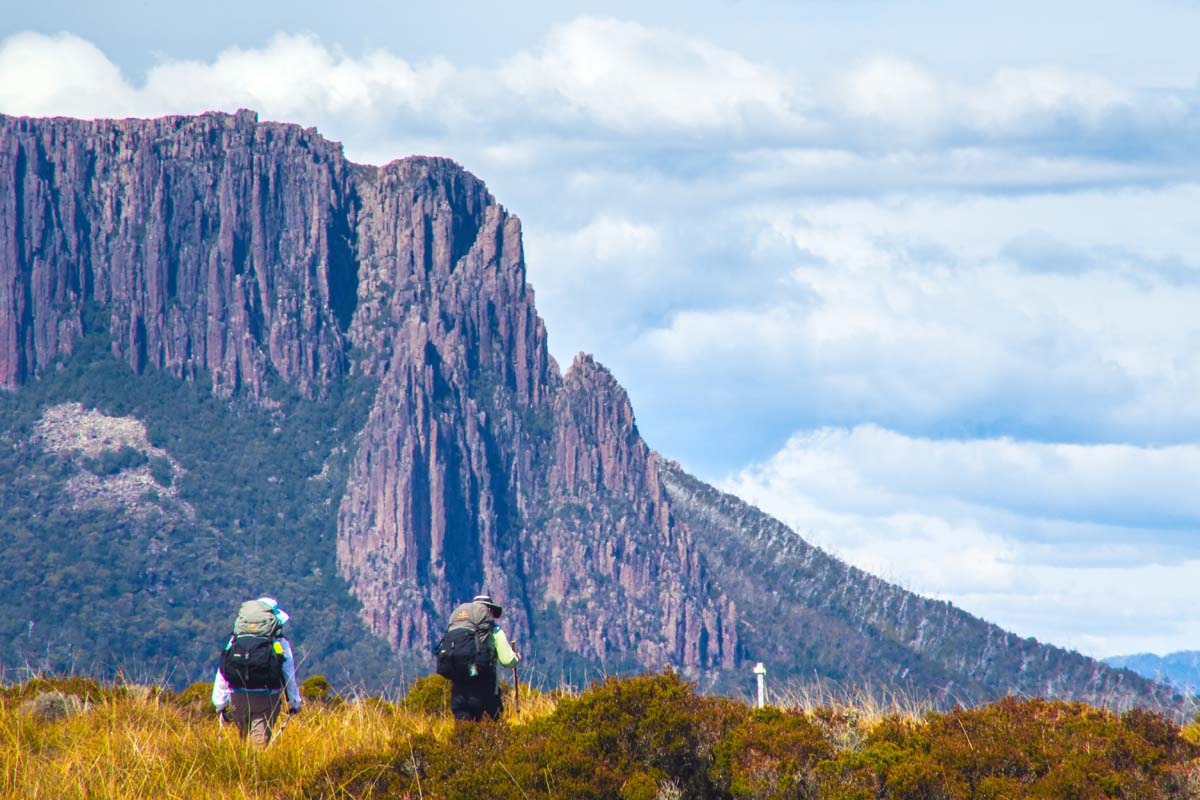
- Day Three Barn Bluff Hut to Pine Forest Moor Hut. 12 km, 6 hours walking. Today we’ll be walking across plains where glaciers once rested, slowly moving and scouring out shallow tarns. The track provides an undulating trek with a few sections of exposed moorland and multiple hill climbs and descents. We take our time venturing across vast button grass plains where ancient pencil pines fringe alpine tarns. Rising from the moors, the peaks of Cradle Mountain and Barn Bluff are behind us. Look ahead, and the stately Mt Pelion West comes into view. Those looking for additional challenge today can take a side trip to Lake Will. Hugged by pencil pines and with its narrow quartzite sand rim, Lake Will is striking. Keep an eye out for gravel mounds along the way, remnants of Joseph Will’s coal mining efforts in the 1890s. Further along the track, Lake Windemere offers an opportunity for an invigorating swim. This evening, at Pine Forest Moor Hut, enjoy dining with views out towards Mt. Oakleigh
- Day Four Pine Forest Moor Hut to Pelion Plains Hut. 10km, 5 hours walking. This morning we venture through gorgeous myrtle-beech rainforest as we descend around the base of Mt Pelion West, down to the Forth River before it plunges into Lemonthyme Valley. We’ll take a break at Frog Flats beside the Forth River, which happens to be the Overland Track’s lowest point. From here, it’s a gentle ascent back out of the valley. We leave thick Eucalypt forest behind as the trees part to reveal Pelion Plains. Uninterrupted views of Mt Oakleigh’s dolerite spires now come into play. The Pelion Plains area offers a host of side trips, hugged by mountainous terrain including peaceful nooks to rest and an abandoned copper mine to explore. Come nightfall, we’ll be nestled amongst dry sclerophyll forest at Pelion Plains Hut.
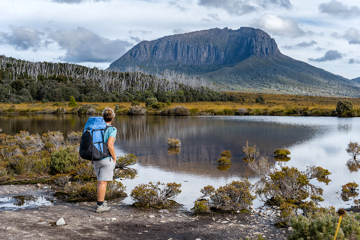
- Day Five Pelion Hut to Kia Ora Hut. 7km, 4 hours walking with optional side trips. Today begins with a climb of almost 300m to Pelion Gap through beautiful rainforest. Pelion Gap is a plateau stretching between Mt Pelion East and Mt Ossa, affording fantastic views to the south as well as back to the north. There’s plenty of time for side trips from Pelion Gap including the option to summit Mt Ossa. At 1,617m, it is Tasmania’s highest peak. There are other less challenging climbs, including to the Japanese Gardens on the slopes of Mt Doris. From Pelion Gap it's a further two hours of gentle downhill to the hut. Today, choose to keep things relaxed or challenge yourself to stand atop the island’s highest point. Once we arrive at Kia Ora Hut, enjoy a Tasmanian drop with spectacular views out to Cathedral Mountain.
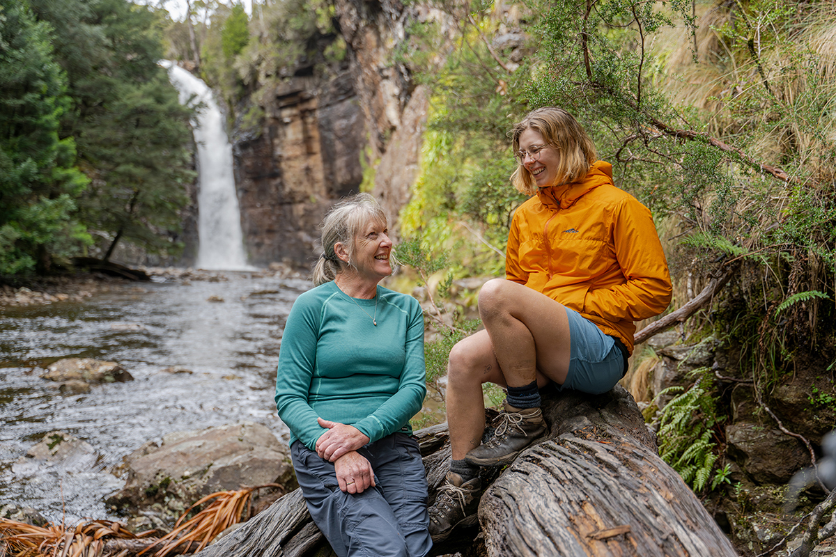
- Day Six Kia Ora Hut to Windy Ridge Hut. 9km, 5 hours walking. Day five is about icy-flowing waterfalls. We depart Kia Ora hut and walk about an hour to Du Cane, where a 1910-built hut remains from the long-gone days of animal trapping. Du Cane Hut is a fine spot to rest, surrounded by native gardens and overlooked by the spectacular Du Cane Range. From here, we wander through some of the oldest forest in the National Park, with King Billy pines as much as 2,000 years old. Now, we are above the Mersey River, which descends deeply northward towards Bass Strait, spilling down cliff faces. There are three major sets of waterfalls in the area. We aim to visit one or more of these, choosing the best to have lunch beside depending on conditions. During the afternoon, we make our way over Du Cane Gap, then descend beside the spectacular Falling Mountain to Windy Ridge Hut. Tonight is a celebratory one, our last evening on the track.
- Day Seven Windy Ridge Hut to Lake St Clair. 10km, 4 hours walking. Our destination today is Australia’s deepest natural lake – Lake St Clair – shaped by glaciations over two million years. Birdsong helps us along this final day as we walk mainly through flowering dry sclerophyll forests. We arrive at Narcissus at the northern end of Lake St Clair in time for lunch, before boarding the Lake St Clair cruise boat for a spectacular 17km cruise back to Cynthia Bay. There’s typically around an hour to look around the Visitor Centre here. The return trip to Red Feather Inn is through the trout fishing mecca of the highland lakes, descending the rugged Western Tiers.
-
Frequently Asked Questions
-
How many guests will be on my trip?
Each trip requires a minimum of 6 and a maximum of 12 guests. All accommodation is twin share. If you book on as a single walker or in an odd-numbered group and the trip fills to capacity, you will share a room with another walker of the same gender.
-
What is the accommodation like?
On Day 1, we stay at Red Feather Inn. Located only a 10-minute drive from Launceston CBD makes this a perfect place to start your walk. Red Feather Inn has a range of heritage rooms and three beautiful cottages, picturesque gardens and an in-house chef. Along the Overland Track, our groups have exclusive use of the only private hut and standing camp accommodation in the national park. Each has been discreetly located off the main trail and offers hot showers, and a dining and lounge area. Sleeping arrangements are 6 twin rooms with comfortable beds, and all huts have a drying room.
-
What do we carry?
Each person must carry their lunch, wet weather gear, spare clothes for the hut, thermals, and warm clothing, plus any extras, such as a camera. For detail please refer to the gear list.
-
How about food?
The guides prepare sumptuous meals each night. We are quite happy to cater for special dietary requirements. We just need to know in advance.
-
What time does the trip commence and conclude?
On the first night, we ask that you be at our walkers base at Red Feather Inn at 5:00pm for a 5:30pm briefing. This allows time for introductions and a gear check before dinner. Your walk will conclude at Red Feather Inn at 6pm with airport drop offs at 6.15pm and Launceston drop offs at 6.30pm.
-
How many guides are there?
Our guides are passionate outdoor enthusiasts, educated interpreters and fantastic cooks all rolled into one. Two knowledgeable guides accompany each trip. This allows plenty of time for interpretation at interesting points along the track, photo opportunities, rest breaks and walking at your own pace.
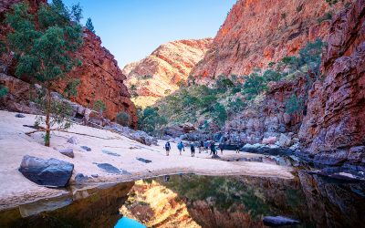
 Alice Springs, NT